History & GeographyVisual listPart 2 of 9, Plate TectonicsUpdated 1 October 2026
Types of Plate Boundary, with Real Examples
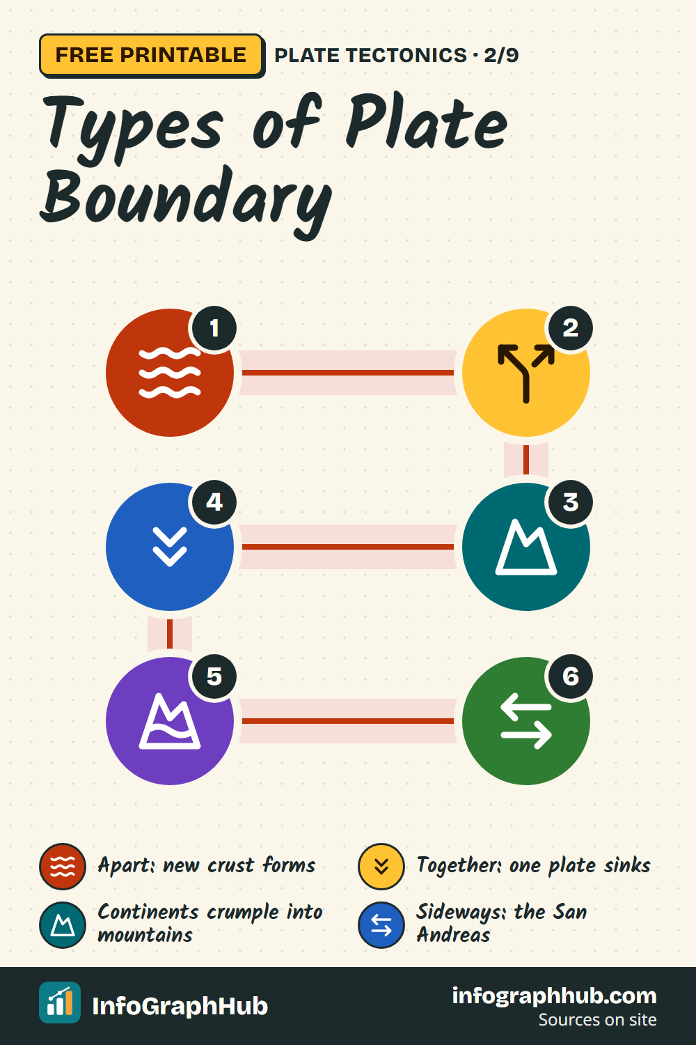
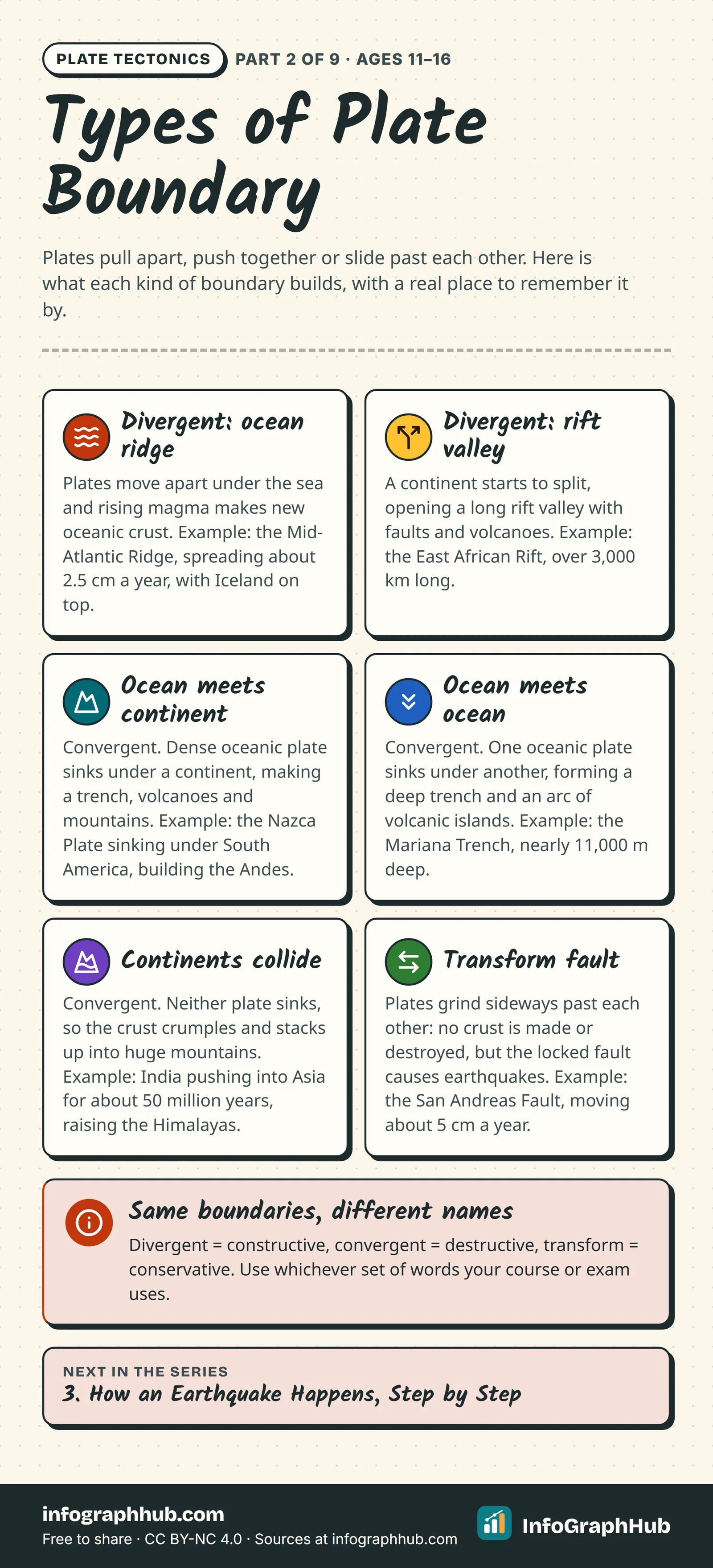
Plates move apart, push together or slide past each other. Six kinds of boundary, each with a real example: the Mid-Atlantic Ridge, the East African Rift, the Andes, the Mariana Trench, the Himalayas and the San Andreas Fault.
Use this infographic
Free under CC BY-NC 4.0, with credit to InfoGraphHub.
Three ways plates can meet
Wherever two plates touch there is a plate boundary, and what happens there depends on how the plates move relative to each other:
- Divergent: the plates move apart and new crust forms in the gap.
- Convergent: the plates move towards each other and crust is destroyed or crumpled.
- Transform: the plates slide past each other sideways.
Some textbooks and exam boards use different names for the same three types: constructive (divergent), destructive (convergent) and conservative (transform). Convergent boundaries come in three versions, depending on whether oceanic or continental plate is involved, which gives the six cards on this infographic.
Divergent boundaries: new crust is made
Most divergent boundaries lie on the sea floor as long underwater mountain chains called mid-ocean ridges. Hot mantle rock rises, partly melts and erupts, building new oceanic crust that moves away on both sides.
The Mid-Atlantic Ridge runs from the Arctic Ocean to beyond the southern tip of Africa and spreads at about 2.5 cm a year. Iceland sits right on top of it, between the North American and Eurasian Plates. During a burst of rifting at Krafla volcano between 1975 and 1984, the ground there was pulled apart by a total of about 7 metres.
A divergent boundary can also start under a continent. In the East African Rift, a zone of faults and volcanoes 50 to 60 km wide stretches more than 3,000 km from Ethiopia southwards. Further north, the same process has already split the Arabian Plate from Africa and let the Red Sea flood in.
Convergent boundaries where a plate sinks
When an oceanic plate meets another plate, the denser oceanic plate bends down and sinks into the mantle. This is called subduction, and the place where it starts is marked by a deep ocean trench.
- Oceanic–continental: off western South America, the oceanic Nazca Plate is sinking under the South American Plate. Melting above the sinking slab feeds the volcanoes of the Andes, and the squeezed edge of the continent has been pushed up into the mountains.
- Oceanic–oceanic: in the western Pacific, the fast-moving Pacific Plate sinks beneath the Philippine Plate. The result is the Mariana Trench, whose deepest point, the Challenger Deep, is nearly 11,000 m below sea level, deeper than Mount Everest is tall. Magma rising from the sinking plate builds a curved chain of volcanic islands called an island arc, such as the Mariana Islands or the Aleutian Islands.
When continents collide
Continental crust is too thick and light to sink far into the mantle. When two continents meet, neither is subducted, so the crust crumples, folds and stacks up.
The classic example is the Himalayas. India began colliding with Asia about 50 million years ago, and most of the mountains' growth has happened in the past 10 million years. Behind them, the Tibetan Plateau sits at an average height of about 4,600 m.
Transform boundaries: sliding past
At a transform boundary, crust is neither created nor destroyed. The plates grind past each other along a fault, locking and then slipping, which causes earthquakes. Many short transform faults cut across mid-ocean ridges and link one stretch of ridge to the next.
The best-known transform boundary on land is the San Andreas Fault in California. The fault zone is about 1,300 km long, and the Pacific Plate on its western side has moved north-west past the North American Plate at an average of about 5 cm a year for the past 10 million years.
Why the type matters
The type of boundary decides what a place experiences. The British Geological Survey notes that divergent boundaries have frequent small earthquakes, transform boundaries can have large shallow ones, and convergent boundaries produce most of the world's earthquakes above magnitude 6. Subduction zones also build chains of explosive volcanoes, while continental collisions build the highest mountains on Earth.
Frequently asked questions
What are the three main types of plate boundary?
Divergent (plates move apart), convergent (plates move together) and transform (plates slide past each other). They are also called constructive, destructive and conservative boundaries.
What is subduction?
Subduction is when one plate, always an oceanic one, bends down and sinks beneath another plate into the mantle. It happens at convergent boundaries and creates deep ocean trenches.
Why don't continents subduct when they collide?
Continental crust is thick and less dense than oceanic crust, so it resists sinking. Instead the crust crumples and piles up into high mountains such as the Himalayas.
Is the San Andreas Fault a plate boundary?
Yes. It is a transform boundary between the Pacific Plate and the North American Plate, which slide past each other at about 5 cm a year.
Sources & methodology
Every fact is checked against the sources below. We write original explanations and draw original graphics; no figures are copied from textbooks. Spotted an error? See our corrections policy.
- This Dynamic Earth: Understanding plate motions (U.S. Geological Survey (USGS), accessed 1 Oct 2026)
- What causes earthquakes? (British Geological Survey (BGS), accessed 1 Oct 2026)
- Cool Earthquake Facts (U.S. Geological Survey (USGS) Earthquake Hazards Program, accessed 1 Oct 2026)
- Pioneers of Plate Tectonics: John Tuzo Wilson (The Geological Society of London, accessed 1 Oct 2026)
Editorial review pending · Updated
Made by the InfoGraphHub editorial team (how we research and check: editorial and AI policy). First published 1 October 2026, last reviewed 1 October 2026. Found a mistake? Tell the editors.
For teachers: ages and curriculum fit
Ages 11–16 · Grades 6–10 (US) · Years 7–11 (UK) · Classes 6–10 (India)
NGSS is a registered trademark of WestEd. Names and codes are used only to describe curriculum fit; InfoGraphHub is not endorsed by these organisations.
Embed this on your site
Paste this HTML into your page. Keep the credit line: it is required by the CC BY-NC 4.0 license.
Related infographics


For teachers and parents: new InfoGraphHub resources by email
One short email when new free resources go live. For adults (18+) only. No spam, no tracking in emails, unsubscribe anytime.